North French River Biodiversity Expedition– July 1 to July 11, 2015
[separator headline=”h3″ title=”Part One: Purpose, Details and Initial Impressions”]
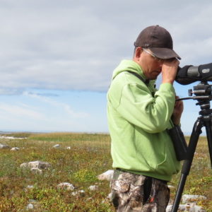
Ted Cheskey
Senior Conservation Manager
 The Moose Cree First Nation (MCFN) want to protect the North French River System from industrial development, including logging, mining and hydro-electric developments. Nature Canada supports Moose Cree in their efforts to protect the North French watershed. The North French River’s main branch starts near Cochrane Ontario, and flows over 200 km north to its intersection with the Moose River just south of Moose Factory. As part of their efforts, they organized an expedition to document the biodiversity along the main branch of the North French, as well as other cultural and aesthetic values and any sign of other human activity. Bernie McLeod, Bird Conservation Program Coordinator for the MCFN Lands and Resources Department organized an 11 day expedition to this end, assembling a team of four that included himself, the trip planner and leader from MCFN Lands and Resources Department, Derek Moses, his daughter Michelle, and yours truly. Bernie has coordinated the Important Bird Area work and other bird conservation work for the MCFN for the past two years, and for the previous few decades was a forestry technician and forest fire fighter, active in some of the most well-known fires across the country from BC to Quebec. Derek “the Bear” Moses works also for MCFN and has a life-long experience of working in the bush and along the rivers including the lower reaches of the North French that are navigable by motor boat. Michelle is in the process of completing high school and determining the next path to take in her young life. My role was to document the birds and other natural history along the way.
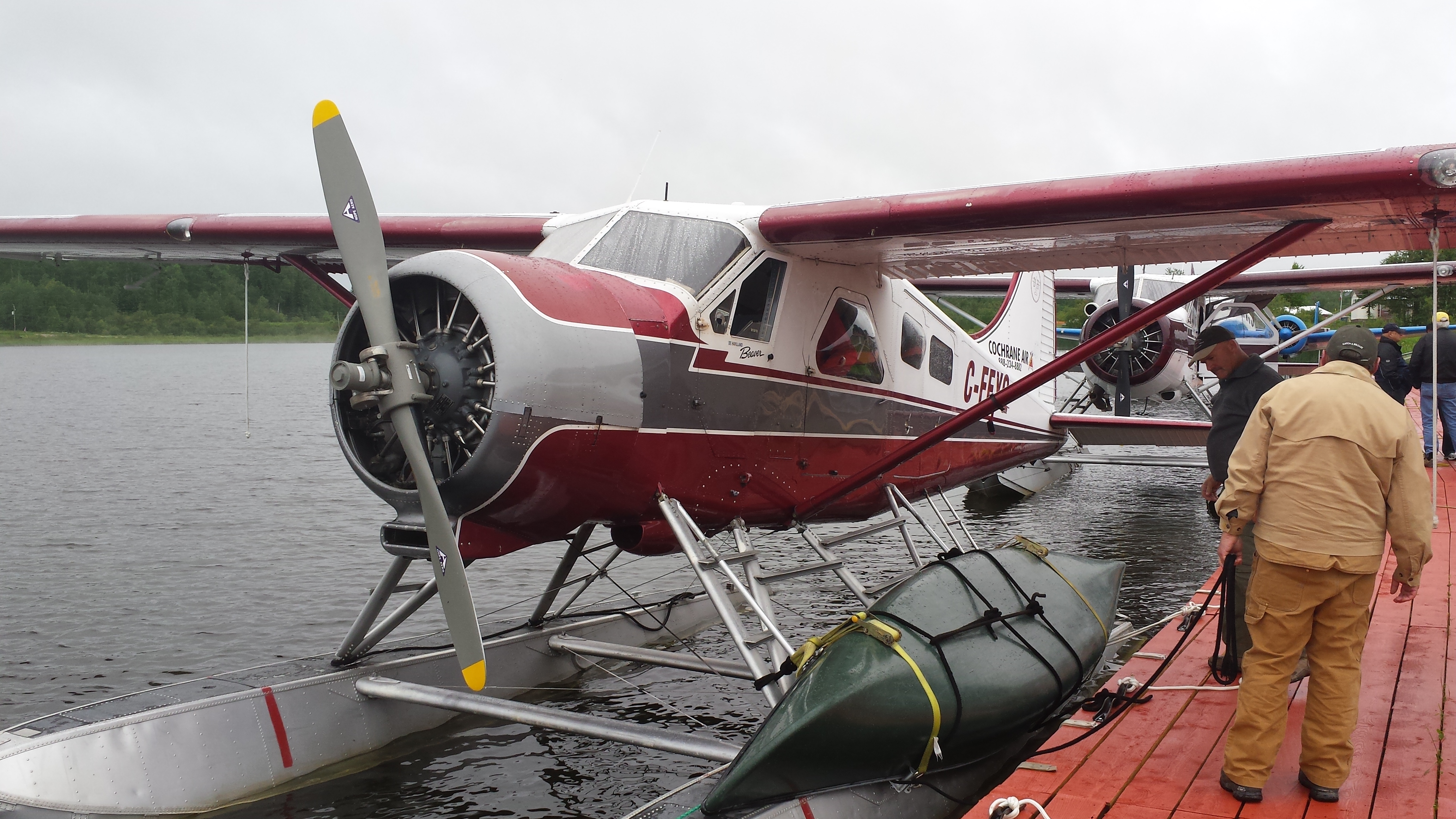
Figure 1: Beaver float plane prepares for takeoff with first canoe and team members
In 11 days, we covered over 200 km of river, descending about 270 metres in altitude from about 80 km north of Cochrane to Moose Factory, a few kilometres from James Bay. The North French is a cold water river in its southern sections, twisting through the spruce dominated boreal forest.
We were dropped by float plane at Sand Lake, about a 20 minute flight north of Cochrane.
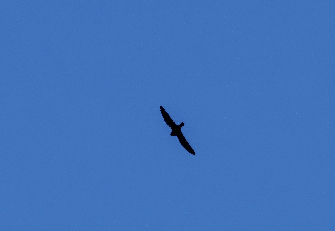
Figure 2: Common Nighthawk hunting near our camp site
After a day of acclimatization, we paddled to the river and began our current-assisted descent – averaging 5.5 to about 9 km/hour while paddling. The first camp site on the river was in an old forest fire (10 plus years) site. That evening the sky was full of more than biting insects, though the mosquito numbers were impressive, even more were the numbers of displaying Common Nighthawks. We knew that this federally threatened specie was in the MCFN homelands, but we didn’t know where, for after a few years of surveying and searches, only a handful of observations were made. From our small campsite perspective on these hundreds if not thousands of hectares of old burn, I observed 6 to 10 individuals, many doing the “boom” courtship display. Perhaps it was the full moon that brought them out, but judging from the large size of the burned over area, it is reasonable to assume a much larger population at that site. Common Nighthawk has been declining over the last 4 decades at a rate of over 4% annually, so we were quite happy to find it doing well. Nighthawks intrigue me by their acrobatic flights and fascinating natural history. Read Jamie Bastedo’s fictional work Nighthawk to learn about this species incredible migration in a great and fun read.
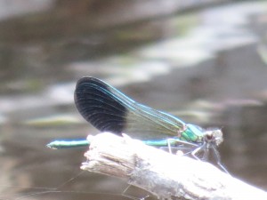
Figure 3: River Jewelwing is common on upper sections of the river
The water in the upper stretches of the river was cold. We were accompanied with large numbers of the striking River Jewelwing – a large damselfly that is an indicator of good stream and river water quality and cold water temperature. I saw no signs of people, no signs of any logging history, no garbage or litter, and no human-made trails virtually the entire trip. This river and its associated watershed are pure boreal wilderness, likely only seeing the passage of a few parties of extreme white water canoe/kayak enthusiasts, and perhaps the occasional trapper from time immemorial. The trees along the river were often tall, wide and impressive in their age. The northern sections were spruce dominated, and there was drama around every corner as trees growing along the banks of the river clung to the edge of the bank, some having their feet literally cut out from under them, and tilted menacingly over the river. A few had fallen into the river presenting dangerous obstacles to our advancement. All along the river, the trunks of virtually all of the large bank-side trees were heavily scarred by the scouring of ice flows in the spring that were 3 or 4 metres above current water levels!
To be continued with part 2 and part 3…

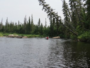 Figure 4: The North French upper reaches with bankside trees angled precariously over the water.