Field Notes from Eeyou Istchee
“Climate Change, pollution, resource extraction, and economic uncertainty threaten the healthy ecosystems and hunting grounds on which Cree communities depend.”
About the program
For over a decade, Nature Canada has worked to support the Cree Nation Government, the Cree Trappers Association (CTA), the Eeyou Marine Region Wildlife Board (EMRWB), and the coastal Cree communities’ interests and efforts to identify and protect important bird and wildlife habitat along the James Bay coast of the Eeyou Istchee. This work began with the question “why haven’t we identified any Important Bird Areas in or around Rupert Bay,” and several years later, has evolved into a much larger initiative in support of the Cree communities and the Cree Nation’s wish to protect their homeland.
In 2019, the Cree Nation Government was awarded a multi-year grant from the Challenge Fund of the Government of Canada to identify new protected areas within the territory of the Cree Nation in Quebec (Eeyou Istchee).
Why we’re doing this work
First and foremost, Nature Canada’s work is in support of the Eeyou Cree, and their wishes to protect their culture and their homelands. With mounting threats from climate change, resource exploration and development, pollution, and economic uncertainty, along with the backdrop of colonialism; the importance of protecting the areas and ecosystems on which the Cree culture depends is crucial. In protecting these areas, other biodiversity also benefits from the protection. Our work, in support of and in partnership with the Cree Nation, has been focused on identifying important bird habitats, documenting the presence of threatened wildlife, and collaborating with the local communities to meet their needs and goals as they relate to our work.
Important bird habitats for this work can be described as places that accommodate large numbers of birds including species of cultural importance like geese and ducks, species that are declining or in trouble like shorebirds, and of course, species at risk such as the federally Endangered Red Knot, the Threatened Hudsonian Godwit and Common Nighthawk, or the Special Concern Yellow Rail.
STAY IN THE KNOW
Subscribe for Updates
Join the Nature Canada online community today for campaign updates, advocacy opportunities, and more.
Follow Our Journey
The Cree and the Land
The Cree have a very strong connection to the land, and to many bird species, particular geese that are a staple in their diet. With a strong interest and determination to protect and maintain their traditional ways of life, including hunting, trapping and living off the land — having healthy ecosystems is an essential part of this.

Waskaganish
(Cree for Little House) is a Cree village of about 2000 people at the mouth of the Rupert River on the south-east shore of James Bay in the Eeyou Istchee territory in Northern Quebec, Canada. It is the most southerly Cree community in Eeyou Istchee. Formerly called Fort Rupert, the location is one of three original Hudson’s Bay Company posts on James Bay, the other two being Fort Albany on the west shore, and Moose Factory on the south.

Eastmain
Eastmain is a Cree village of about 900 on the south shore of the Eastmain River near James Bay. The territory of Eastmain, designated as Category 1 land, is comprised of 489.53 square kilometers. The town itself has about 8 kilometers of, now paved, roads and is accessible year-round by a gravel access road and via Air Creebec. The Cree Trappers Association’s office is in Eastmain.

Wemindji
Wemindji, from wiimin uchii meaning “ochre hills” in Cree formerly known as Old Factory, a little island 45 kilometres south of the current location. Wemindji has been relocated since 1959 and sits at the mouth of the Maquatua River on the east coast of James Bay, in northern Quebec, Canada. Since the relocation of their people from Old Factory Island to their current location, Wemindji has grown at a rapid pace now home to over 1,400 people. The Cree people who live here, who also call themselves Iyiyuuch in their own language, meaning “the people” have a deep attachment to our past and to keeping our traditions alive. The Iyiyuuch continue to practice the ancient hunting, fishing and trapping way of life that sustained our ancestors for many generations. Today within their community, a third of the population still live year-round in the bush, while others go back to their family traplines’ on weekends or when they have free time.
Chisasibi
Where the “Great River” shelters a growing local and non-local population. Chisasibi is the biggest of all the nine Cree communities of the Eeyou Istchee territory. A real northern metropolis, the rich Cree culture pulses with a living past and a promising future. Although Chisasibi Cree people still undertake traditional activities like trapping, fishing, hunting, picking, etc., many of our community members work into one of the many organizations located in the village. Counting over 5,000 people, Natives and non Natives, Chisasibi has been established more than 35 years ago. This major relocation from Fort George island to the current Chisasibi site is an inevitable chapter of the history of our community.

Whapmagoostui
Whapmagoostui, is the northernmost community located at the mouth of the Great Whale River on the coast of Hudson Bay in Nunavik. It’s home to approximately to 960 Cree and 740 Inuits. Whapmagoostui means the Place of the Whales. It is the only Cree coastal community in Eeyou Istchee not accessible by road.
Eeyou Istchee and Cree Nation Government
Eeyou Istchee, which means the People’s Land, comprises eleven Cree communities and over three hundred “traplines,” or traditional family hunting and trapping grounds. Our traditional territory, an area of over 400, 000 square kilometres, or two-thirds the size of France, is located primarily in northern Quebec and includes the lands on the eastern shore of James Bay and south-eastern Hudson Bay, as well as the lakes and rivers that drain into them. In addition, our traditional territory includes lands which we have historically occupied in Ontario, across the Ontario-Quebec border. Eeyou Istchee is home to over 18,000 people.

Cree Trappers Association (CTA)
The Cree Trappers’ Association’s mandate and responsibility consist in protecting and promoting the interests and values of Eeyou/Eenou trappers, traditional pursuits, and governance of hunting territories in Eeyou Istchee. This mandate extends to the management of territory and wildlife resources and of environmental matters. The main goals of the Association are:
- To foster, promote, protect and assist in preserving the way of life, values, activities and traditions of the Eeyou/Eenou trappers of Québec and to safeguard the traditional system of Eeyou/Eenou traplines.
These “traditional systems” have prevailed over time, and are of great significance and importance to the Cree Nation for any future agreements. Today, the CTA continues to represent and defend the values, traditions, and practices of its members.
More recently, under the Eeyou Marine Land Claims Agreement (EMRLCA), the CTA’s responsibilities in the coastal regions are as follows:
- To be regularly consulted by the Wildlife Board on wildlife management matters;
- To consult its members and recommend wildlife management measures;
- To have a role in the monitoring of harvesting activities and ensure that harvesters are aware of all special measures implementation in the Eeyou Marine Region;
- To allocate and enforce basic need levels where quotas are applicable.
Eeyou Marine Region Wildlife Board
The Eeyou Marine Region Wildlife Board (EMRWB) is established as the main instrument for managing wildlife in the EMR. The board has four members appointed by the Cree Nation Government, one member appointed by the Government of Nunavut and two members appointed by the Government of Canada. The Crees have the exclusive right to harvest certain species and they have the right to harvest any species of wildlife in the Eeyou Marine Region to fulfill their economic, social and cultural needs. Some restrictions may be considered to allow for conservation.
CERRI
CERRI, or the Chisasibi Eeyou Resource and Research Institute, is the Cree Nation of Chisasibi’s research center. It is a community-based and community-driven research organization with a crucial mandate to provide scientific information to Chisasibi community members and beyond. At CERRI, we combine traditional knowledge and conventional(western) scientific principles to understand the Eeyou way of life. We train young generations in scientific methods and help document ecosystem changes. Our researchers work with local knowledge holders to study ecosystems, document traditional ecological knowledge, assess cumulative effects, and monitor the environment.
Other partners
Environment and Climate Change Canada – Canadian Wildlife Service | Nature Conservancy of Canada | Birds Canada
National Audubon Society
The National Audubon Society protects birds and the places they need, today and tomorrow, throughout the Americas using science, advocacy, education, and on-the-ground conservation.
The Journey Thus Far
Since 2012, with the support of funding from Environment Canada’s Aboriginal Fund for Species At Risk and Habitat Stewardship Program, we have planned field expeditions based on Indigenous-led knowledge, and our own review of maps and images of the coast that lasted from a few days to multiple weeks. In 2012, starting in Waskaganish, we focused initially on the marine zone including Rupert Bay, Boatswain Bay and the offshore Islands including Charlton Island. This work followed a process, established from the start that includes seeking and confirming community support, including meeting with Chief and Councils, seeking advice and local knowledge on areas to survey and the status of species, getting permission to visit areas and use existing facilities such as camps when needed, and engaging local people in the field work as much as possible. Information from our surveys belongs to the Cree Nation and the communities. It will be used to inform their protected area initiatives.
2013 – 2017
Expeditions were primarily in the territory of the Cree Nation of Waskaganish in Rupert Bay, Boatswain Bay and some of the islands including Charlton Island – the largest in eastern James Bay.
2013 and 2014
Partners: Cree Nation Government, Cree Trappers Association, Cree Trappers Association of Waskaganish, Nature Canada, Nature Quebec, Marc-Antoine Montpetit (2014), Environment and Climate Change Canada.
Surveyed coastal areas and the small nearshore islands in Rupert Bay, especially Cabbage Willows, a 3000 + hectare prairie/ marsh wetland complex on the northwestern side of Rupert Bay. Cabbage Willows includes an equally large and expansive mudflat at low tide that provides thousands of hectares of foraging habitat for shorebirds, including large numbers of Hudsonian Godwits. The wetlands support high populations of otherwise uncommon species such as Nelson’s and LeConte’s Sparrows and the at-risk Yellow Rail. For the Rail, we confirmed a significant population by visiting known and potential habitat and imitating its “song” by tapping two stones together, which the rails interpret as other rails within their territory and to which they can respond by their own “singing.”
2015 and 2016
Partners: Cree Nation Government, Cree Trappers Association, Cree Trappers Association of Waskaganish, Nature Canada, Nature Quebec, Marc-Antoine Montpetit, Environment and Climate Change Canada, Birds Canada.
Focused on the larger islands in James Bay, particularly Charlton Island These islands have significant shorebird habitat, supporting important numbers (hundreds) of Red Knots, and large numbers of several shorebird species including thousands of Semipalmated and White-rumped Sandpipers, several hundred Greater and Lesser Yellowlegs, and a great diversity of other species. There were impressive mammal observations also. One of our teams had a safe, but close encounter with a Polar Bear. We observed evidence of Polar Bear on several islands, as well as abundant signs of Caribou. Included on our list of aquatic mammals along the James Bay coast were Ringed Seal and Northern Beluga.
There were some surprises. These included confirming a new breeding population of the Federally-listed species (Special Concern) Horned Grebe. What was remarkable about this was that the nearest known breeding population is over 1000 kilometers away.Also remarkable was how it was found. Marc Antoine Montpetit, a talented field ornithologist from southern Quebec had visited the area several years before and noticed Horned Grebes. He was determined to look for evidence of their breeding on Charlton Island. His tenacity to check all of the beaver ponds just back from the shoreline soon paid off, leading to the first breeding confirmation of the species in the region. We also found large rafts of thousands of Black and Surf Scoters. Mussel populations in the offshore waters were plentiful, making the area a perfect location for their wing moult.
In 2016, with the support of Birds Canada, a partner conservation organization, we also installed Motus Wildlife Tracking receiver stations in some of the coastal communities and other remote sites. The station at the CTA Office in Waskaganish detected several Red Knots, migrating north to their breeding grounds from their wintering areas in southern South America within the first year.
The Motus telemetry network of receiver stations detects radio signals from transmitters that are attached to birds and sometimes-other wildlife. These tiny transmitters stay on birds for several months emitting radio signals regularly. Each tag emits a unique signature so we can determine where animals go, how fast they transit between points (migration ecology), and how long they stay in an area (stop-over ecology), among many aspects about their behavior and conservation. The purpose of Motus is to facilitate landscape-scale research and education on the ecology and conservation of migratory animals.
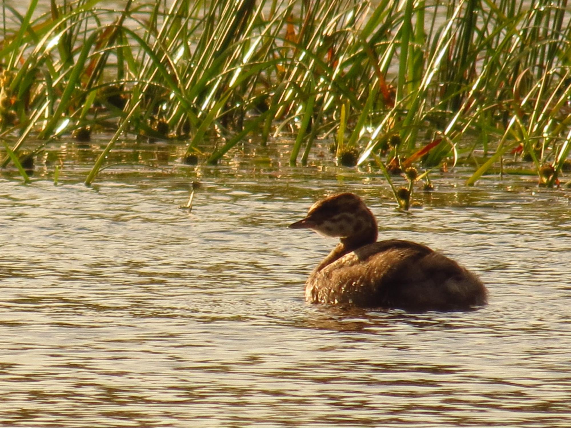
Horned Grebelette on Charlton Island | Photo by Ted Cheskey
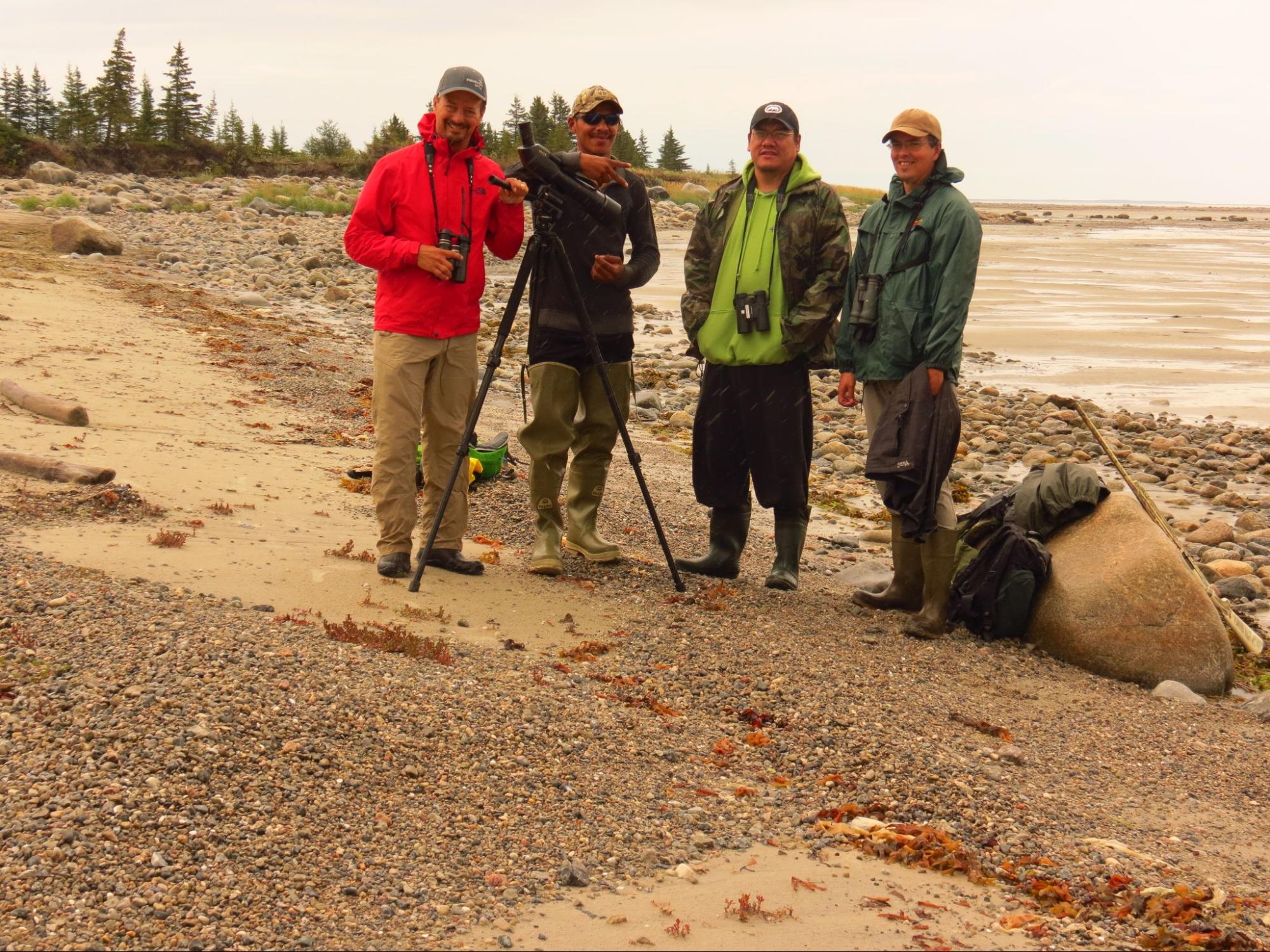
Ted, Clayton Joly, Gary Sault, and Marc Antoine Montpetit on Charlton Island
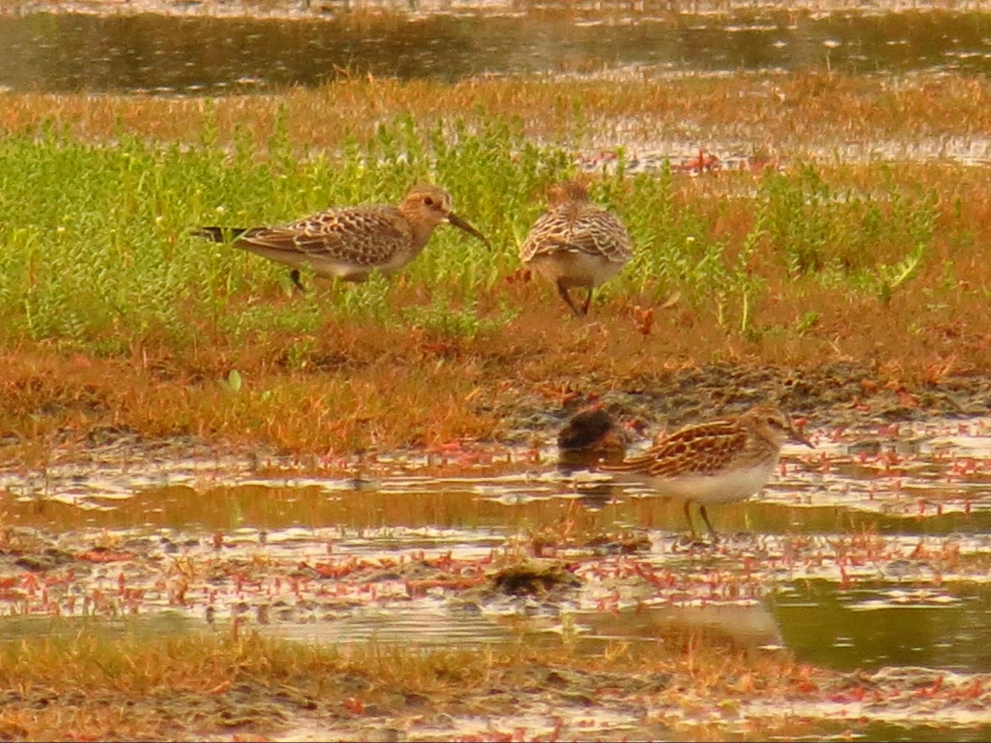
Least Sandpiper (foreground) and Baird’s Sandpiper (background) on Charlton Island
2017
Partners: Cree Nation Government, Cree Trappers Association, Cree Trappers Association of Waskaganish, Eeyou Marine Region Wildlife Board, Nature Canada, FaunENord, Marc-Antoine Montpetit, Environment and Climate Change Canada, Birds Canada.
Spring and late summer surveys in Boatswain Bay. Extremely difficult to access by boat, we were able to move around Boatswain Bay by helicopter, displacing two or three small survey teams.
Boatswain Bay is a large, crescent-shaped bay just to the north of Rupert Bay, on James Bay. It includes a very large wetland complex, extensive mudflats and a small archipelago of islands offshore that appear to provide birds foraging on the mudflats with safe habitat at high tide. At Boatswain Bay, we observed tens of thousands of shorebirds foraging for invertebrates on the mudflats and beaches in mid-summer. Boatswain bay is a Migratory Bird Sanctuary. One of these species was the Endangered Red Knot which was present in the hundreds at times. The wetlands at Boatswain have breeding populations of many uncommon species including Yellow Rail, Marbled Godwit, Wilson’s Phalarope and Nelson’s Sparrow.
The work since 2013 led to recognizing and designating a new Important Bird and Biodiversity Area, the Globally significant Miinshtuk-Wiinebek IBA which filled a large gap in the distribution of IBAs along the James Bay coast.
2019
Partners: Cree Nation Government, Cree Trappers Association, Eeyou Marine Region Wildlife Board, Cree Trappers Association of Wemindji, Marc-Antoine Montpetit, Environment and Climate Change Canada.
In early September, we conducted 10 days of surveys along the coast of Wemindji from Walrus Island in the north to Old Factory Bay in the south. We were only able to conduct the surveys late in the migration season. Likely most birds had left by that point, though we were able to locate important habitats and find some very rich areas where there were still concentrations of over 1000 individual shorebirds, though some species that peak in early August, like the Red Knot, were not detected. We did locate a “new” species, not documented along the eastern James Bay coast – a Northern Wheatear.
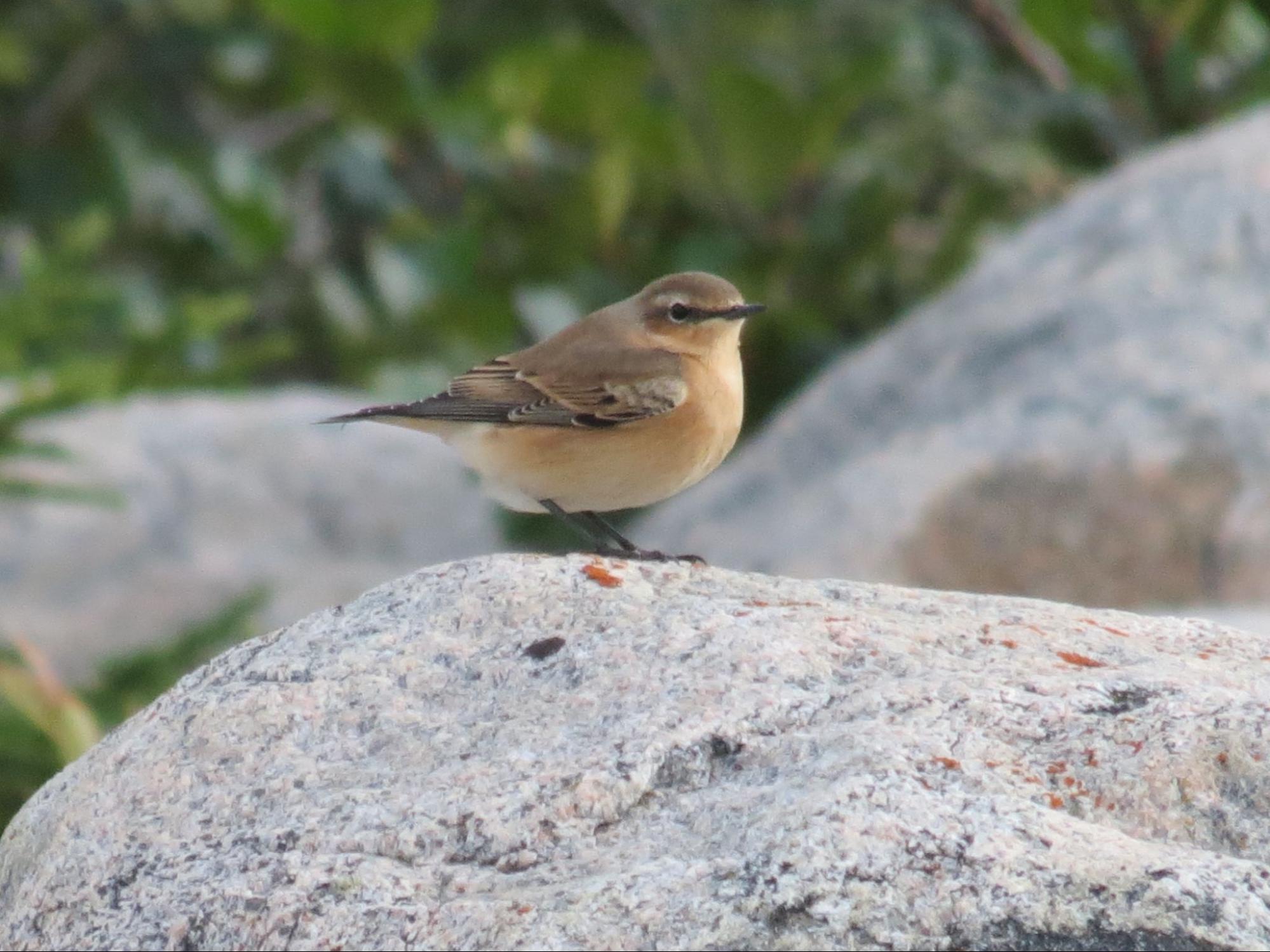
Northern Wheatear | Photo by Ted Cheskey
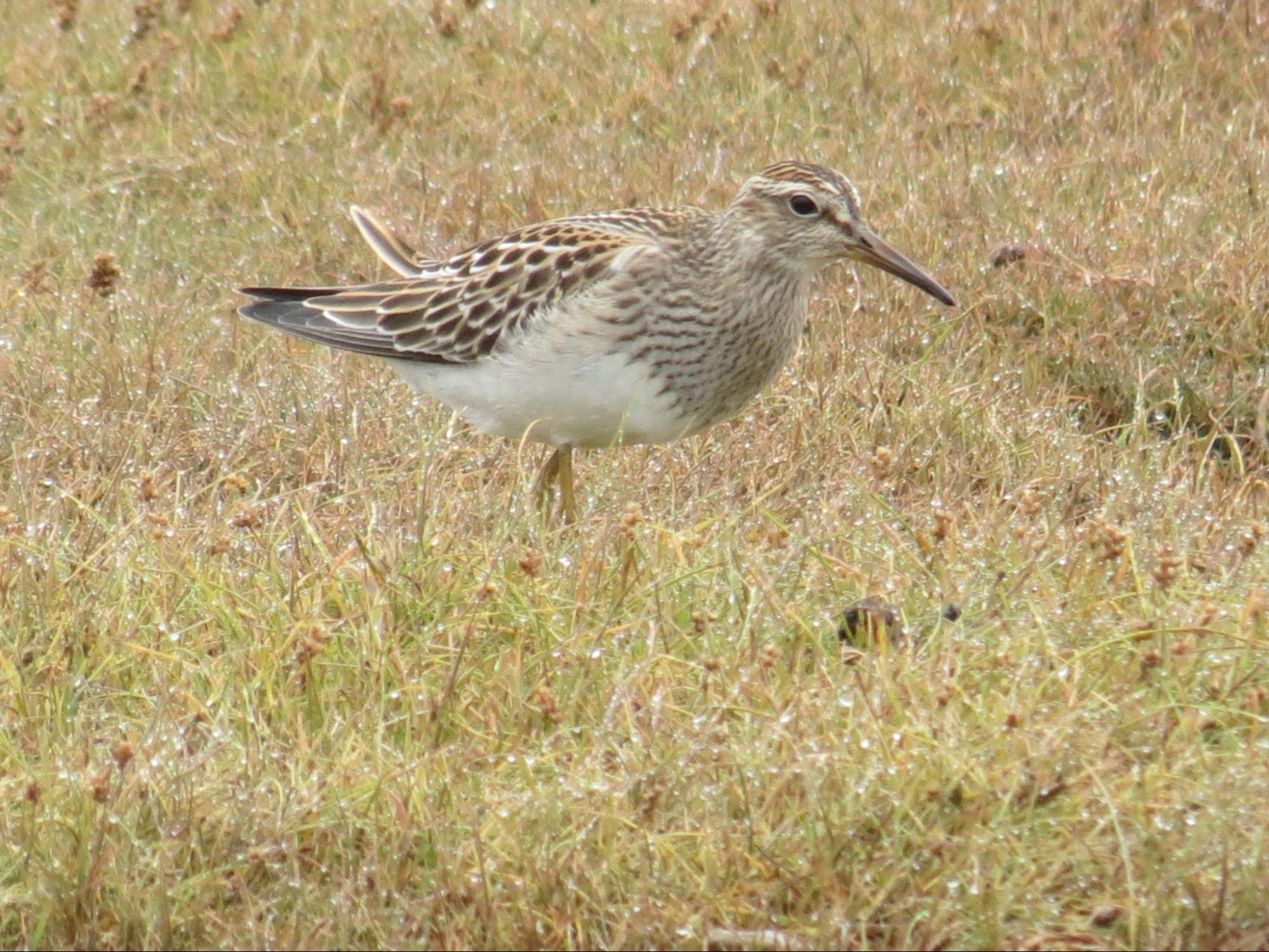
Pectoral Sandpiper | Photo by Ted Cheskey
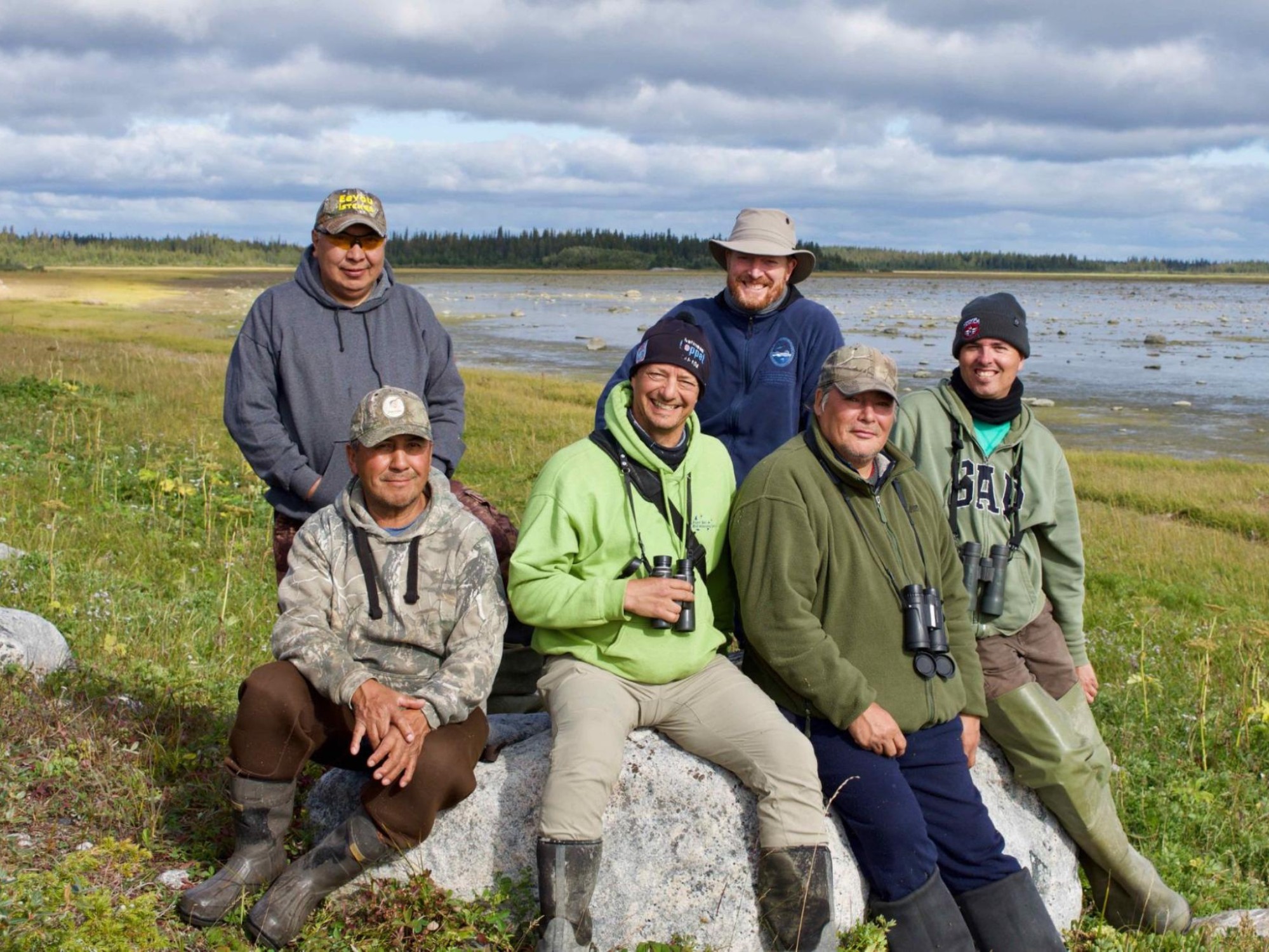
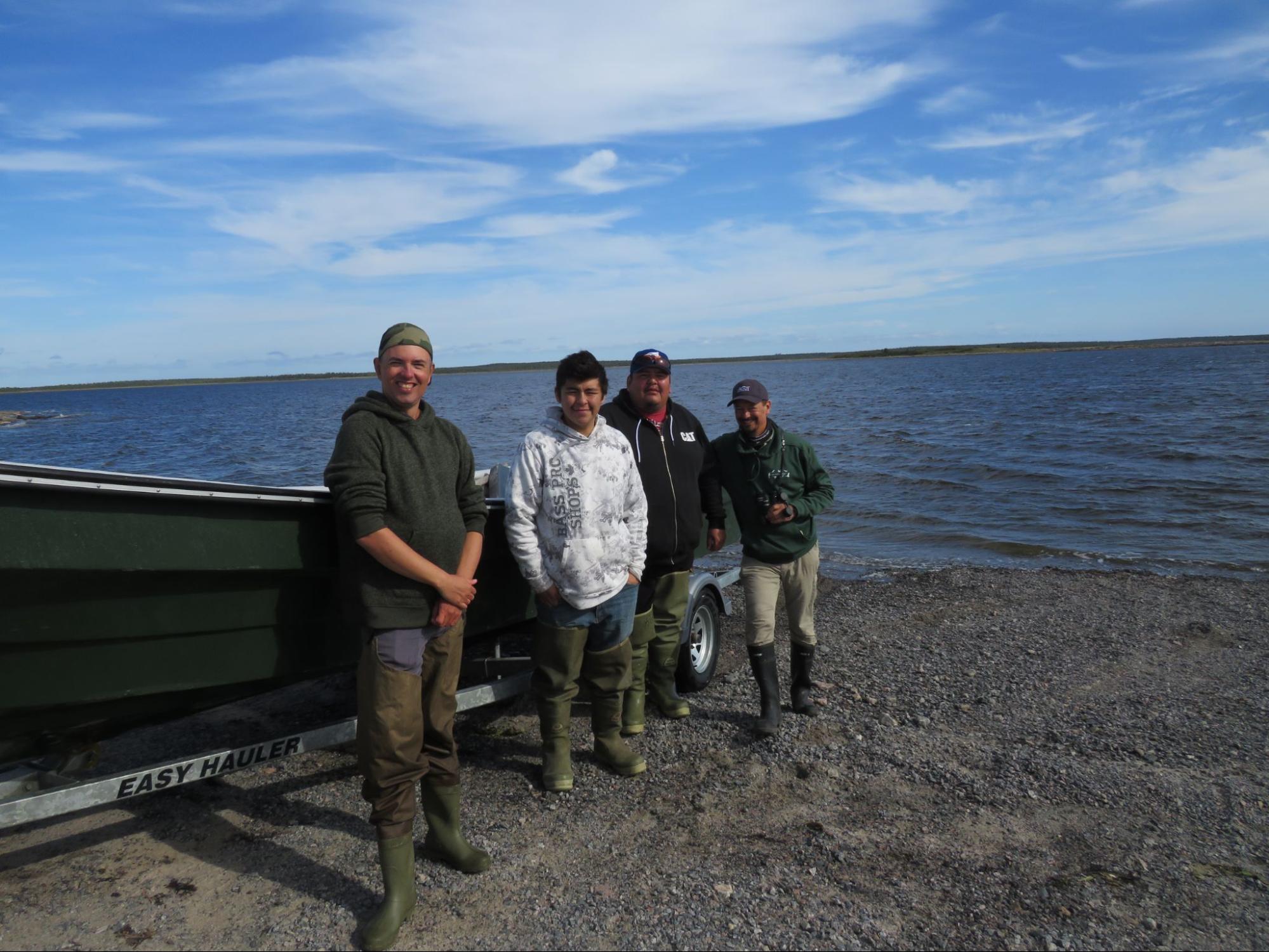
The Wemindji Team
Front, left to right: Henry Stewart – Boat Captain and Tallyman, Ted Cheskey, Ernie Hughboy – Boat Captain and Tallyman, Marc Antoine Monpetit
Back, left to right: George Natawapineskum – EMR Officer, Felix Boulanger – Biologist, EMR
2020
Partners: Cree Nation Government, Cree Trappers Association, Cree Trappers Association of Wemindji, Marc-Antoine Montpetit, Environment and Climate Change Canada.
In March, when COVID first became a global concern, we believed that we would be able to survey the coast three months down the line. As the collective situation became more and more precarious, it was clear that we would be unable to survey. Instead we shifted our focus towards community engagement and hosted several webinars, classroom talks and other digital engagement opportunities for the communities in which we would otherwise have been working in. While our visits always contain an engagement opportunity for communities, this provided the space to focus on this aspect of engagement. Very excitingly, we were able to work with Elder, and Cree language expert Luci Salt from Chisasibi to develop a Northern Cree dialect animation of our comic ‘A Year in the Life of a Red Knot’.
2021
With the remote nature of the communities where this work takes place, it was not safe to have southerners entering the communities, potentially acting as vectors for the disease. Surveying was postponed again.
2022
Partners: Cree Nation Government, Cree trappers Association, Eeyou Marine Region Wildlife Board, Chissasibi Environmental Resource and Research Institute, Marc-Antoine Montpetit.
From mid-July to mid-August we conducted coastal surveys based out of the three northernmost communities in Eeyou Istchee, Wemindji, Eastmain and Chisasibi in that order. We were able to survey just over half of the planned field days in each community, encountering strong winds or rain days which rendered travel on James Bay too dangerous, thus preventing surveys. As with 2019 surveys, stretching our time in Chisasibi into August’s late migration window impacted the number of birds we were able to count. Over the course of the field season we had several highlights, such as; finding a family of breeding Willow Ptarmigan on a small offshore island. Being invited to stay and survey on Cape Hope Island by its long-time steward, George Kudulu was extraordinary, as was hearing a Gray Catbird in Chisasibi which is well outside its known range.. We also found nesting Lapland Longspurs and located another significant moulting area for scoters. Overall we observed over 20 thousand individual birds consisting of 123 species.
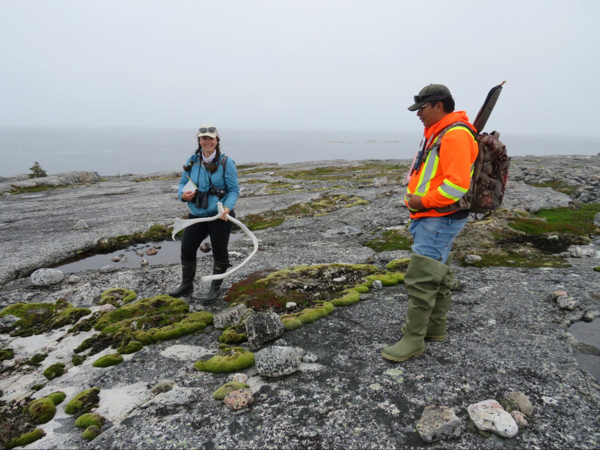
Lara Falkiner with Eric Georgekish and caribou antler
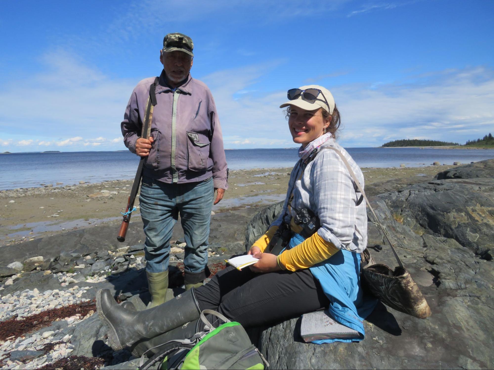
George Kudulu and Lara Falkiner
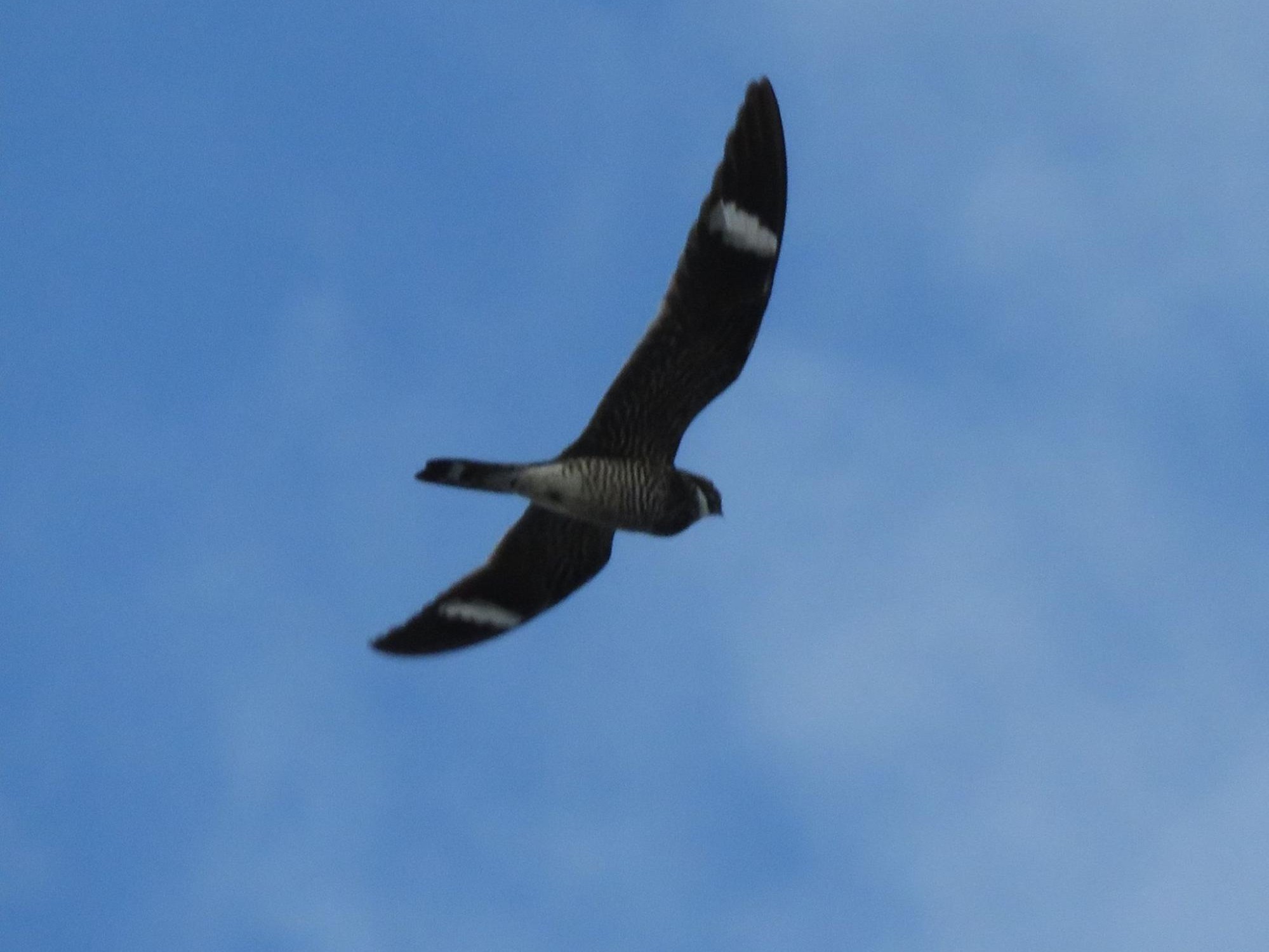
Common Nighthawk in Chisasibi | Photo by Ted Cheskey
Marc Antoine Montpetit, Rusty House, Ross House, and Ted
2023
Partners: Cree Nation Government, Cree Trappers Association, Eeyou Marine Region Wildlife Board, Chisasibi Environmental Resource and Research Institute, Marc-Antoine Montpetit.
This year was to be the last in the Challenge Grant window and we had Identified areas in Chisasibi and Eastmain as the final survey sites. However, with days to spare before our departure, Canada’s worst wildfire season on record kicked off. The only access road to the communities was shut and Communities themselves went in and out of evacuation alerts all summer. Because of this, we did not conduct surveys this year, but were able to interview local land users about their observations on the fire impacts on wildlife and estimate the number of birds impacted, based on data from the Boreal Avian Monitoring Project (BAM) and eBird (through National Audubon) that will deepen our collective understanding of the scale of impacts of the fires on bird populations. We are grateful for our partnerships with BAM and National Audubon in the analysis of data to estimate the impact of the fires on breeding and migrating birds. A fifth Cree coastal community in Eeyou Istchee called Whapmagoostui is on the Hudson Bay coast. We hope to extend our work to their territory one day.
Threatened Shorebirds in the Eeyou Istchee
Shorebirds, as a group, require special conservation attention. They have declined by about 40 percent over the last 50 years. The worst off among these, about ⅓ of North American Shorebird species, having lost over 70% since the 1980s (State of the Birds, 2022).
Shorebirds are a group of birds from two main families, the sandpipers and the plovers. Sandpipers have relatively long beaks that can be curved or straight, along with relatively small heads, whereas plovers have short stout beaks and relatively big heads. Both have long legs and are found along the shores such as beaches, mudflats, and rocky headlands where they use their beaks to get food on or beneath the surface.
These are both large families and include individual species that live in a wide range of habitats. In the sandpiper family, species range in size from very large Whimbrel with its distinctive drooping bill or the equally large Marbled Godwit with its very long and straight bill, to the tiny Least Sandpiper, the smallest of this clan.
In the group of plovers observed along James Bay, the size difference is less dramatic, but spans Black-bellied Plover, which is a bit larger than a Robin, to the Semipalmated plover, which is about half the size of its black-bellied cousin.

Hudsonian Godwit
This coastal migrant has an extremely small breeding range that extends from the coast of Northwestern Hudson Bay to the Mackenzie Delta. This large, long-billed shorebirds also has a tremendous migration that takes it to the tip of South America and back. It uses that long bill to probe deep into mud and tidal flats in search of worms, molluscs, and other invertebrates. Along James Bay, watch for the big and impressive shorebird in the rich bays and coastal mud flats near river deltas.


Red Knot
There are three subspecies of Red Knot in Canada: rufa, roselaari, and Islandica. Rufa is listed as Endangered on Schedule One of the Species at Risk Act (SARA), and is the subspecies that breeds at lower latitudes of the Canadian Arctic. Rufa populations migrate through Cree homelands of James Bay to the Gulf of Mexico and southern South America. Roselaari, the more westerly subspecies, breeds in Alaska and Siberia and is listed as Threatened by SARA. Islandica is the easterly subspecies, breeding on the northeastern islands of the Arctic Archipelago including Baffin Island and Greenland. Its status is Special Concern.
The Rufa Red Knot’s migration is legendary! It migrates about 30,000 km annually from the Arctic breeding grounds to Tierra del Fuego (Chile/Argentina) and back. Learn more about it in our comic A Year in the Life of a Red Knot. Rufa Red Knots spend days to weeks feeding and resting along the James Bay coast before multi-day flights south to the Atlantic Ocean, the Gulf of St. Lawrence or the coastal USA and from there to South America. Several sites within the coastal territory of the Cree Nation of Waskaganish may be important stopover habitats for this species. The western side of James Bay is extremely important as stopover area for the Red Knot, accommodating as much as thirty percent of the Rufa population. Part of our work is to determine if there are more important migratory stopovers for Red Knots north of Boatswain bay along the coastal zone of eastern James Bay.


Buff-breasted Sandpiper
This species is less common than the previous two along the James Bay coast, but occasionally is found along the coast or in areas of habitats characterized by short grassy vegetation. This small-headed sandpiper with bright yellow legs is listed as Special Concern on Schedule One of SARA. Unlike most sandpipers, this species also is found in dryer areas. It over-winters in the southern cone countries of South America (Brazil, Argentina, Uruguay and Paraguay).


Red-necked Phalarope
Phalaropes are aquatic shorebirds, observed outside their breeding season on open water including the open ocean. Along the coast of James Bay, this species can turn up on migration of small ponds inland from the water’s edge. This phalarope is listed as Special Concern on Schedule One of SARA. It breeds across the arctic, from Labrador to Alaska, and winters largely on the open ocean of the coasts of North America. Unlike other shorebirds, the female phalarope is more brightly coloured, and the male exclusively incubates the eggs.

The Challenge Grant Project
In 2019, the Cree Nation Government was awarded a multi-year grant from the Challenge Fund of the Government of Canada to identify new protected areas within the territory of the Cree Nation.
As part of this project, Nature Canada, in partnership with the CTA and EMR, has been organizing and leading expeditions along the coastal zone of Cree communities to identify important places for birds and species at risk which will be coming to a close in 2024.
Work began in Wemindji in 2019, with an early September expedition focussing on shorebirds. Our team included George, CTA-EMR Local Officer, Henry and Ernie, local tallymen and boat pilots, Marc-Antoine Montpetit, expert birder, Felix Boulanger, the biologist with the EMRWB, the cook and myself. Over 9 days we observed 90 species, identified several important sites, and even had some surprises. The biggest was finding two Northern Wheatears, a small songbird of the Eastern Arctic and northern Europe that had never been observed along the eastern James Bay coast previously!
DELAYS
Due to the COVID -19 pandemic and safety guidelines, expeditions in 2020 and 2021 were postponed. In 2023, wildfires threatened the communities, closed access from the south and expeditions were again postponed.
THE FUTURE
Our intention is to identify and compile information based on our observations and those from the community, that allows us to map the important places for birds. It will then be up to the Cree Nation Government, the local communities and all of the other partners to use that information to protect the coastal ecosystem for the Cree and for the birds.
Resources
Resources used in the field and related educational materials produced through the work and collaboration this project inspired.
eBird
eBird is among the world’s largest biodiversity-related science projects, with more than 100 million bird sightings contributed annually by eBirders around the world and an average participation growth rate of approximately 20% year over year. A collaborative enterprise with hundreds of partner organizations, thousands of regional experts, and hundreds of thousands of users, eBird is managed by the Cornell Lab of Ornithology. eBird began with a simple idea—that every birdwatcher has unique knowledge and experience. Our goal is to gather this information in the form of checklists of birds, archive it, and freely share it to power new data-driven approaches to science, conservation and education. At the same time, we develop tools that make birding more rewarding. From being able to manage lists, photos and audio recordings, to seeing real-time maps of species distribution, to alerts that let you know when species have been seen, we strive to provide the most current and useful information to the birding community.
A Year in the Life of a Red Knot
Nature Canada and the CNG produced a comic book about the Red Knot, a species of shorebird that migrates through the coastal zone of James Bay in late spring and summer. The comic is about one particular Red Knot named RUFUS. It tells the remarkable story about the first year of Rufus’s life and his migration from its arctic breeding grounds on Southampton Island to the southern tip of South America and back – a 30,000 km round trip. Along the way, we learn about the threats to the species and the special areas where it likes to stop.
Great Travelers
Every year, great travelers pass through the homelands of the Cree along James Bay. These feathered superheroes are known as shorebirds. Learn about the shorebirds found in this region and how some of the Cree communities are doing things to help these birds with their partners.
Motus Wildlife Tracking System
The Motus Wildlife Tracking System is a collaborative research network that uses coordinated automated radio telemetry arrays to study movements of small animals. Motus is a program of Bird Studies Canada in partnership with Acadia University and collaborating researchers and organizations.